
Drain Tracing and Mapping Survey for Housing Development in Talke
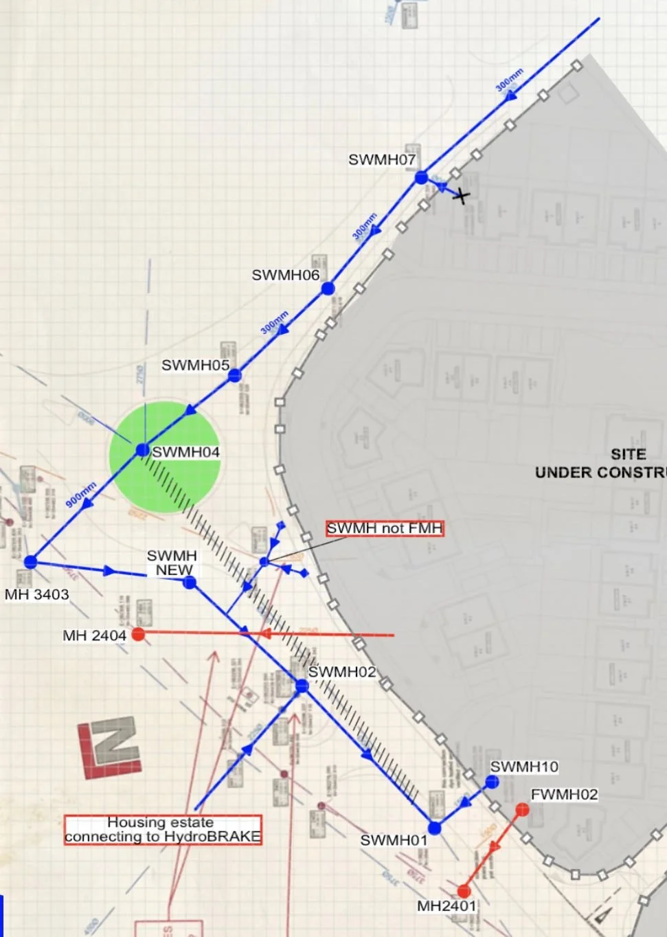
Comprehensive drainage tracing, mapping and CCTV survey carried out in Talke, near Stoke-on-Trent, to confirm the layout, connectivity and suitability of existing foul and surface water drainage assets ahead of a proposed housing development.
The survey identified drainage entry points onto the site, confirmed pipe sizes, materials, invert levels and flow directions, and provided accurate drainage layout data for planning and design purposes.
Location: Talke, Stoke-on-Trent
Service: Drain tracing and mapping
Overview
We were instructed to undertake a detailed drain tracing and mapping survey of a designated development site in Talke, near Stoke-on-Trent, to support plans for a proposed housing development.
The purpose of the survey was to establish how the existing drainage infrastructure entered, crossed and discharged from the site. This information was required to help the project team understand whether the existing foul and surface water drainage systems were suitable for accepting proposed new connections.
For housing developments, accurate drainage information is critical at the planning and design stage. Assumed drainage routes can lead to design issues, connection problems and costly changes later in the project. By carrying out CCTV inspection and drainage tracing, we were able to provide the client with verified drainage information rather than relying on historic or assumed layouts.
What we did
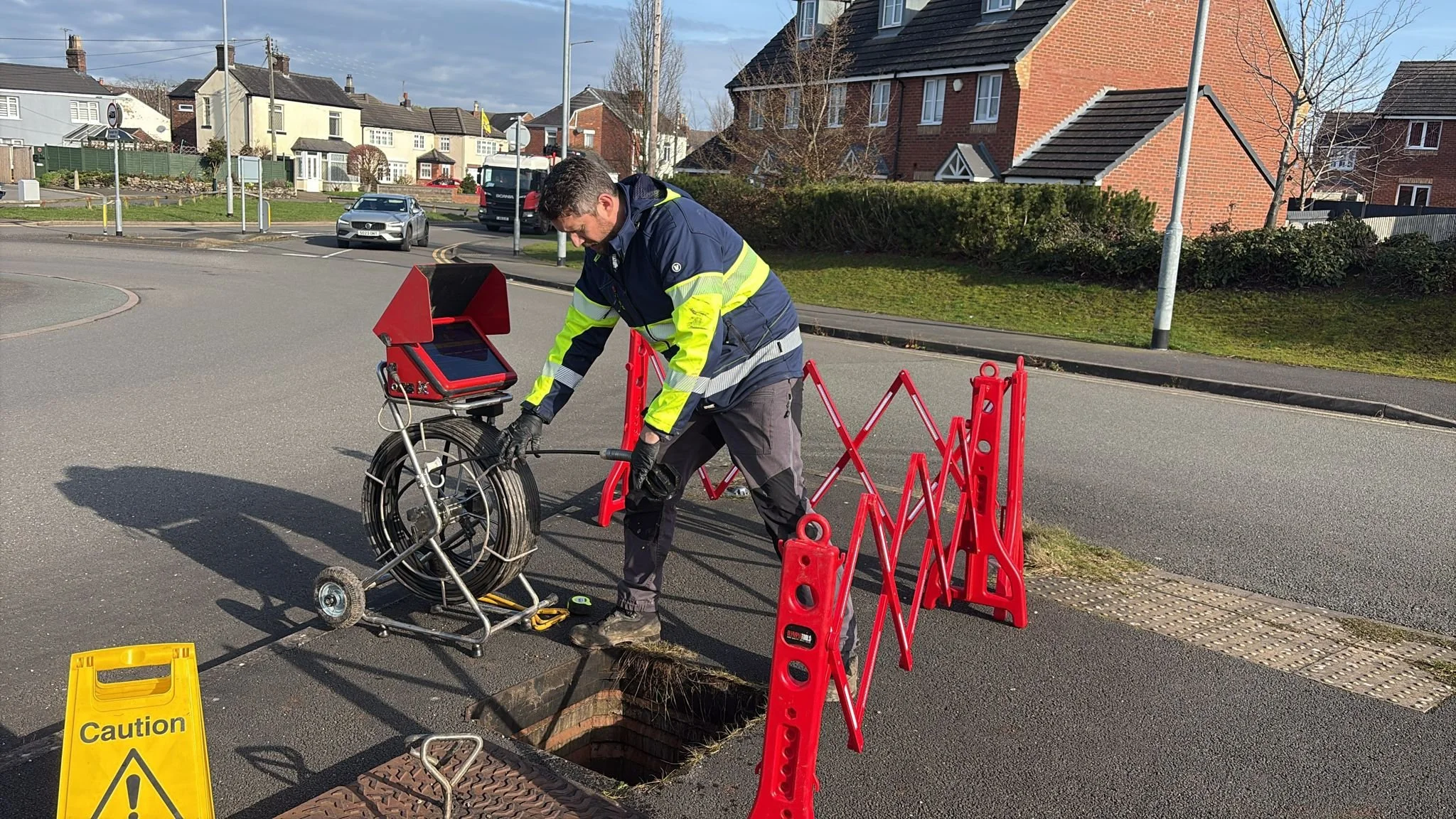
We attended the site in Talke to complete a comprehensive drainage investigation using CCTV inspection equipment, drainage tracing tools and a crawler camera where required.
The scope of works included:
Identifying all drainage entry points onto the site
Confirming pipe sizes and materials
Recording invert levels
Establishing direction of flow
Confirming connectivity and discharge routes
Assessing functionality and hydraulic suitability for proposed connections
Tracing drainage routes across the site
Incorporating drainage layout data into the client-provided CAD file
The survey identified a total of four drainage lines entering the site, comprising two surface water lines and two foul drainage lines. Pipe sizes varied significantly across the site, from 150mm foul sewers through to 900mm surface water sewers. Due to the size and nature of the drainage infrastructure, we used a combination of push rod camera, crawler camera and sonde locator to inspect and help map the network accurately.
During the investigation, we also confirmed that the direction of one of the surface water lines differed from the previously assumed route. The CCTV and tracing survey established the correct alignment of this line, allowing the drainage mapping to be updated to reflect the accurate infrastructure route.
All identified drainage runs were traced to confirm their connectivity, flow direction and discharge points, allowing the project team to assess whether the existing system could support the proposed development connections.
The outcome
The survey provided the client with a clear and accurate understanding of the existing foul and surface water drainage infrastructure serving the proposed housing development site in Talke, near Stoke-on-Trent.
The completed findings were compiled into a WRc-standard drainage report, including defect coding where applicable, invert levels, connectivity schedules and supporting imagery. Drainage layout data was also incorporated into the client-provided CAD file to support planning and design work for the proposed housing development.
By confirming the correct drainage routes, entry points, pipe sizes, invert levels and discharge points, the survey helped reduce uncertainty at the design stage and provided the evidence needed to make informed decisions about proposed connections.
The discovery that one surface water line followed a different route than previously assumed was particularly important. Without the drainage tracing and mapping survey, the project team may have continued working from inaccurate drainage information, increasing the risk of design changes, delays or connection issues later in the project.
This project is a strong example of how drain tracing, CCTV drainage surveys and accurate drainage mapping can support housing development planning, helping developers and design teams understand existing infrastructure before construction decisions are made.
Location
This drain tracing and mapping survey was carried out in Talke, near Stoke-on-Trent, to support planning and design work for a proposed housing development.
We regularly undertake CCTV drainage surveys, drain tracing and drainage mapping for housing developers, civil engineers, architects and planning consultants across Stoke-on-Trent, Newcastle-under-Lyme, Talke, Kidsgrove, Alsager, Tunstall, Burslem, Longton and the wider Staffordshire area, helping confirm drainage layouts, connectivity, invert levels and suitability for proposed connections before construction begins.
Related services
Related services: